Document the roof without anyone climbing onto it.
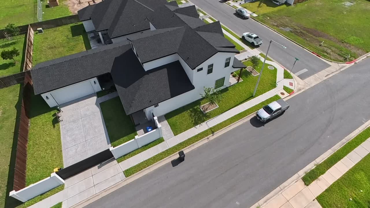
High-resolution photo and video of residential and commercial roofs across the Valley, for insurance claims, storm damage, and property evaluations. Timestamped, organized, and formatted so you can forward it.
What's included
Nobody goes up a ladder
The riskiest part of a roof inspection is getting onto the roof. We shoot every slope from the air instead, including the pitches nobody should be walking in the first place.
Every slope, in order
A straight-down frame of the whole roof, obliques from all four corners, then detail shots of each slope. Every anomaly gets a numbered close-up and a wider frame showing where it sits.
Evidence that holds up
Every frame is timestamped, and each one is numbered against a straight-down overview so there's no guessing where it was taken. The report carries the address, the date, the time, the weather, the aircraft and its FAA registration, and the pilot's Part 107 number.
We document. We don't adjudicate.
We write down what's visible: 'displaced shingle, south slope, three feet from the ridge.' Cause and settlement are your adjuster's call, and we stay out of it.
What you get
- ✦Straight-down overview of the full roof, plus obliques from all four corners
- ✦Detail frames of every slope, with each anomaly photographed and numbered
- ✦Slow walkaround video covering roofline, gutters, flashing, and penetrations
- ✦PDF report: address, date, time, weather, pilot certificate, numbered callouts
- ✦Full-resolution originals with capture timestamps intact
From flight to link
One capture becomes an experience anyone can open in a browser.
Capture
We shoot each room as a full 360° sphere on a 360 camera, then a licensed Part 107 pilot and a visual observer fly the exterior and the aerial. One visit, both halves.
Process
We stitch and color the capture into a web-native, interactive experience on our pipeline.
Deliver
You get a link within 24–48 hours. No files to download, no app to install. It opens on any phone or browser.
Explore
Embed it on your site, text it to a client, post it anywhere. Anyone can step inside.
We're shooting this one now.
Sample inspection report is on the schedule. Leave your email and we'll send it over once it's cut.
Be one of the first venues we work with
We will capture one community, venue, or listing as a full inside-out 360° experience at no cost. You get a finished, embeddable tour; we get a founding case study to launch with.
You get: a complete 360° aerial experience, hosted and ready to embed.
We ask: permission to feature the result as our founding case study.
Not ready yet? Get on the launch list.
We will let you know the moment we open bookings in the Valley.
Questions about this service
A finished, web-hosted 360° experience: a link you can open on any phone or browser and embed on your own site. Not a folder of raw files you have to edit. The experience is the deliverable.
Typically 24 to 48 hours after the flight. You get a single link, ready to embed and share.
Sí. We are based in the Rio Grande Valley and work in English and Spanish, on the ground, locally, and fast.
Yes. We fly high-resolution aerial photo and video documentation for residential and commercial roofs — no ladder or roof access needed. The footage is timestamped and delivered as a report-ready image set, suitable for insurance claims, storm damage assessments, and property evaluations. We do not offer thermal imaging at this time; our inspection service is visual documentation only.